
DLG GROUP · BUYER FOUNDATIONS / PROPERTY RECORDS
One property, several records: identify what each can answer.
Identify the parcel and its jurisdiction before reviewing use, boundaries, taxes or proposed work. Keep each official record with its date and note which questions it can and cannot answer.
An address is a starting point. Before comparing renovation options or annual costs, establish the property identifier, the interest being purchased and the government offices responsible for the location. Keep the source, date and limits of each record visible.
1. Build a property identity sheet
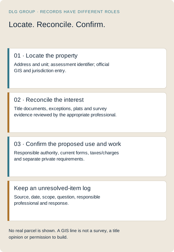
Record the street address, unit designation if any, assessor's parcel/tax identifier, named local jurisdiction, source URL and access date. Then ask your title/closing professional to reconcile those identifiers with the documents describing the interest being transferred. A listing label, an assessor category and a legal description have different purposes.
| Record group | Use it to ask | Do not assume |
|---|---|---|
| Assessment / tax record | Which identifier, recorded characteristics, assessment year and tax information are shown? | That the assessed value is a current sale appraisal or a future tax guarantee. |
| GIS / map layers | Which mapped parcel, jurisdiction and available planning layers relate to the address? | That an on-screen line establishes a legal boundary or is suitable for setting out work. |
| Recorded title / plat / survey material | Which interest, description, exceptions and boundary questions require professional review? | That a downloaded deed alone resolves every encumbrance or use question. |
| Planning / zoning / permit authority | Who decides the proposed use and work at this location, using which current process? | That an assessor's dwelling count or a neighbour's project grants approval. |
| Association / private documents | What additional review, maintenance or use restrictions need to be examined? | That private consent replaces public approval, or vice versa. |
2. Start from the correct official local entry point
Boston, Massachusetts. The city's property-data page provides routes to property lookup, record cards, parcel/value data and tax information. [P01] This is a City of Boston example. Use the appropriate municipality for a property elsewhere in the Boston region; do not apply Boston's entry point to every metro address.
Fairfax County, Virginia. The county GIS page links mapping resources and the assessment service. Its Digital Map Viewer description includes property and zoning map books. [P02] The assessment entry was reachable but displayed a maintenance notice during this check. [P03] Availability can change; use the official county contact or entry route when a tool is unavailable.
Fulton County, Georgia. The official county maps page is an entry point to local mapping resources. [P04] It is not evidence that the county handles every permit for a given Atlanta-area property. Identify whether a city or county authority handles the proposed work, and use that authority's current requirements.
Review scope on 21 October 2026: official information/entry pages were checked; no real address, parcel result, title record, tax calculation or map export was tested in these portals. A working information page does not establish that every linked application or record query works.
3. Bring use and boundary questions to the documents
Before locating a fence, drain, deck, addition, solar array or accessory structure, ask which recorded and current site information the responsible professionals need. Request explanation of relevant easements, rights-of-way, shared access and restrictions rather than inferring their location or meaning from a photograph.
Use a question log: “Document/reference”; “area or proposed work affected”; “professional explanation required”; “design or access implication”; “authority confirmation”; and “unresolved.” A rough map mark can help describe the question to your team, but should not become the contractor's setting-out instruction.
Keep property-line and maintenance questions separate. A strip maintained by an owner may still need record review before work; an association's maintenance role may differ from the boundary of an owner's interest. See ownership and responsibility and association documents.
4. Build the tax and local-charge file
Request the current bill and assessment record, identify the period and taxing authority, and list amounts paid separately from the mortgage payment. Ask the responsible office or professional what information is needed to estimate future charges for the intended ownership and work. Do not carry a seller's payment or exemption into your budget without confirmation.
Separate public taxes/charges, association dues, proposed assessments, utility charges and one-time project or connection fees. Record whether an amount is current, historical, quoted, assumed or still unknown. An empty cell means unresolved; it should not silently become zero in the ownership-cost example.
5. Reconcile records with the proposed project
- Confirm the correct property and unit identifiers.
- Obtain the relevant title/site documentation and professional review.
- Identify the authority for the precise work and use.
- Request current forms, submission requirements and fees from that authority.
- Check association and other private requirements separately.
- Record unresolved limits before commissioning a final design or comparing fixed-price proposals.
Continue with renovation permits and work sequence and closing evidence. This guide improves document organization; it does not certify title, legal boundaries, permitted unit count or development potential.
Sources and scope
- P01 — Boston property data and information; official entry and record routes.
- P02 — Fairfax County GIS and Mapping Services; official mapping entry.
- P03 — Fairfax assessment portal; maintenance notice observed, no parcel query completed.
- P04 — Fulton County maps; official entry only.
Local routes checked 21 October 2026. Portal status, forms and local requirements must be refreshed for an actual property and submission.